

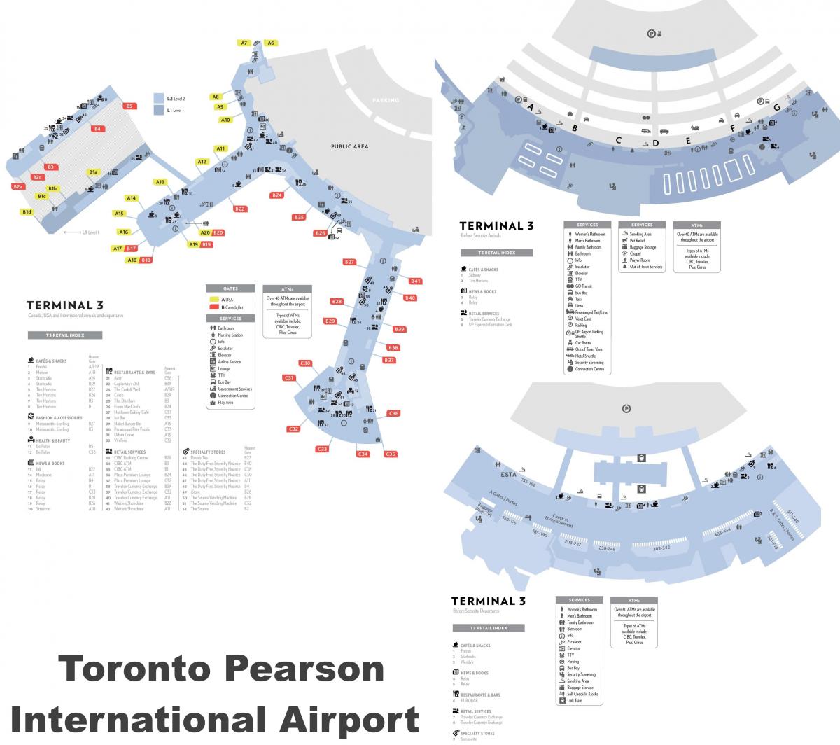
You can find on this page the Toronto airports map to print and to download in PDF. The Toronto airport map presents terminals and gates of the international airport of Toronto in Canada.

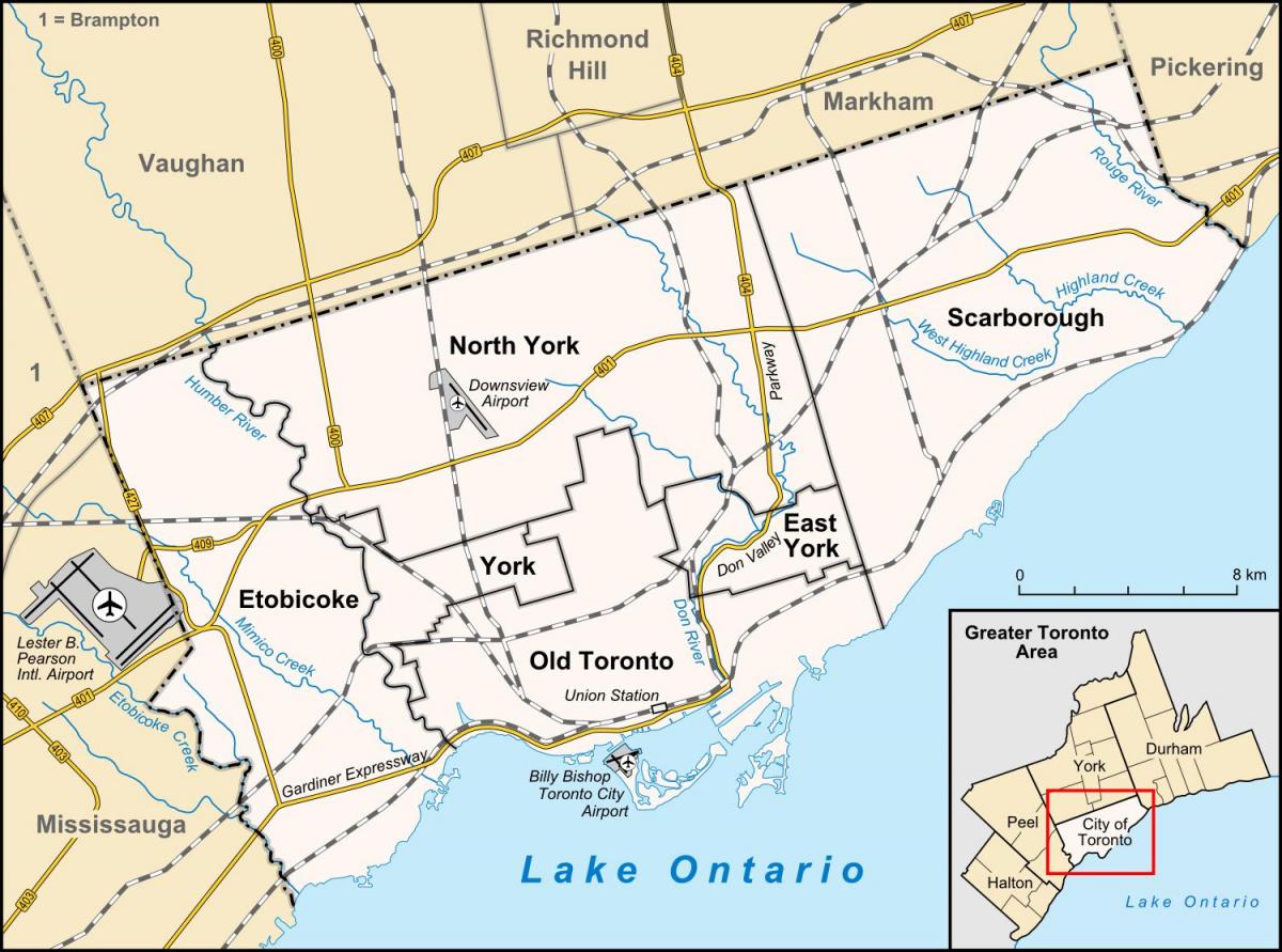
The Toronto airports map shows all the airports around Toronto. This airports map of Toronto will allow you to determine which airport you will used to leave Toronto in Canada. The Toronto airports map is downloadable in PDF, printable and free.
Canada busiest airport, Toronto Pearson International Airport (IATA: YYZ), straddles Toronto western boundary with the suburban city of Mississauga. Limited commercial and passenger service is also offered from the Billy Bishop Toronto City Airport, on the Toronto Islands, southwest of downtown as its shown in Toronto airports map.
Toronto/Buttonville Municipal Airport in Markham provides general aviation facilities. It is a medium-sized airport in Buttonville, Ontario, Canada, within Markham, bordering Richmond Hill and 29 km (18 mi) north of downtown Toronto as its mentioned in Toronto airports map. It is operated by Toronto Airways Limited. Due to its proximity to Toronto suburbs.
Toronto/Downsview Airport, near the city north end, is owned by de Havilland Canada and serves the Bombardier Aerospace aircraft factory. It is located in Toronto, Ontario as you can see in Toronto airports map, and has been exclusively owned and used as a testing facility by Bombardier Aerospace since 1994.
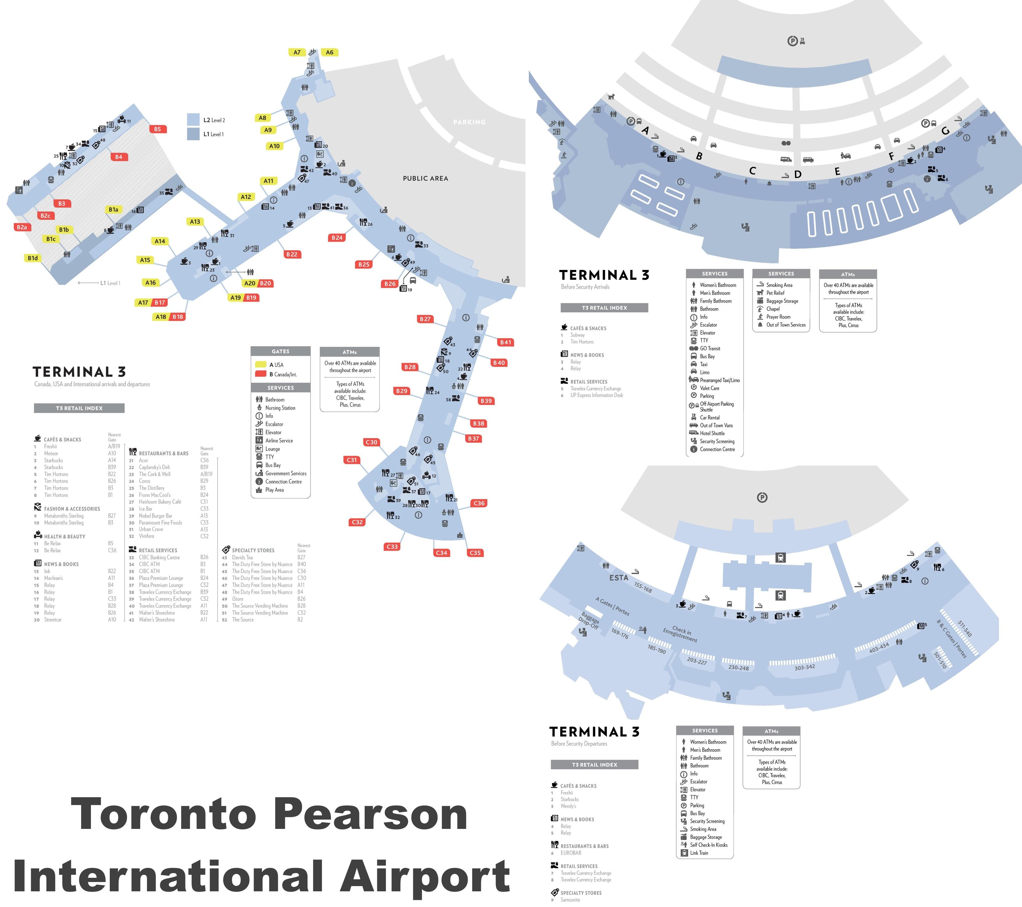
The map of Toronto airport presents the main international airport of Toronto. This international airport map of Toronto will allow you to determine by which terminal and gate you will arrive or leave Toronto in Canada. The airport Toronto map is downloadable in PDF, printable and free.
Toronto Pearson International Airport (also known as Lester B. Pearson International Airport or simply Pearson Airport) (IATA: YYZ, ICAO: CYYZ) is an international airport serving Toronto, Ontario, Canada (see Toronto international airport map); its metropolitan area; and the Golden Horseshoe, an urban agglomeration that is home to 8.7 million people (about 25% of Canada population).
Toronto international airport is located 22.5 km (14.0 mi) northwest of Downtown Toronto as its shown in Toronto international airport map, with the bulk of the airport lands located in the adjacent municipality of Mississauga. Toronto international airport is named in honour of the late Canadian Prime Minister and Nobel Peace Prize laureate Lester Bowles Pearson. Pearson is the largest and busiest airport in Canada, being almost twice as large as Vancouver Airport (which is the second busiest).
Toronto international airport is the largest hub for Air Canada, making it a major Star Alliance hub airport (see Toronto international airport map). Toronto international airport is also a hub for passenger airlines Air Canada Express, Air Transat, CanJet, Sunwing Airlines and WestJet, as well as cargo airline FedEx Express. The airport is operated by the Greater Toronto Airports Authority (GTAA) as part of Transport Canada National Airports System and is one of eight Canadian airports with facilities for United States border preclearance.