

You can find on this page the Toronto transport map to print and to download in PDF. The Toronto transportation map presents the transports network and transport zones of the transit of Toronto in Canada.
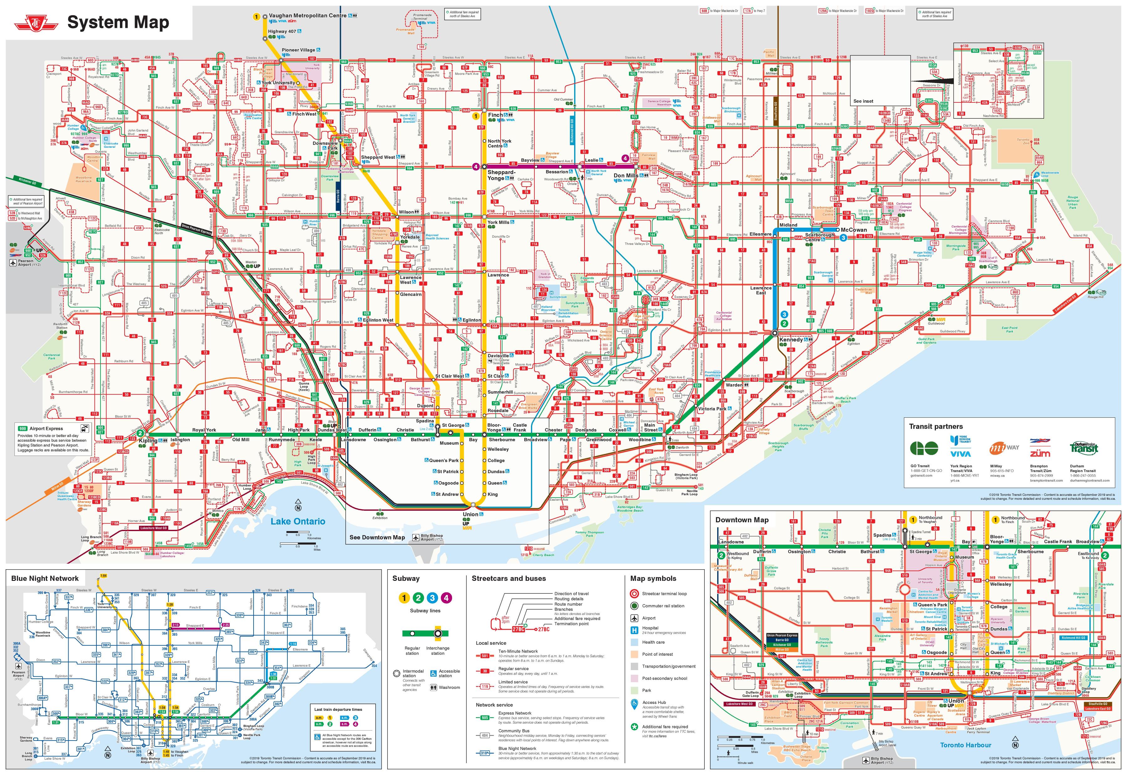
The Toronto transport map shows all means of transportation in Toronto. This transports map of Toronto will allow you to move easily with public transport of Toronto in Canada. The Toronto transportation map is downloadable in PDF, printable and free.
The TTC is the main public transport provider in Toronto, running a subway system, streetcar lines and bus routes across the city as its mentioned in Toronto transports map. To make use of the transport system often involves taking more than one vehicle to get where you are going, which is why understanding the TTC transport system is helpful to anyone who lives in or is visiting Toronto.
The best way to get around Toronto is by public transport. The Toronto Transit Commission (TTC) runs three modes – subway, streetcar and bus – which operate extensive routes throughout the city and suburbs as you can see in Toronto transports map. You will need a token or a pass to travel on TTC; day and week passes allow for unlimited rides on all three forms of public transport.
Public transport is a great way for visitors to get around Toronto. Toronto transports is an easy, safe, and quick way to get around; in many cases it will also save you a lot of money compared to renting a car and paying for expensive downtown parking (see Toronto transports map). The Toronto Transit Commission (TTC) provides service within the city of Toronto (including all of downtown), ferries connect to the Toronto Islands, and GO Transit handles commuter service to the suburbs.