

You can find on this page the Toronto tourist map to print and to download in PDF. The Toronto tourist attractions map presents the monuments, museums, parks and points of interest of Toronto in Canada.
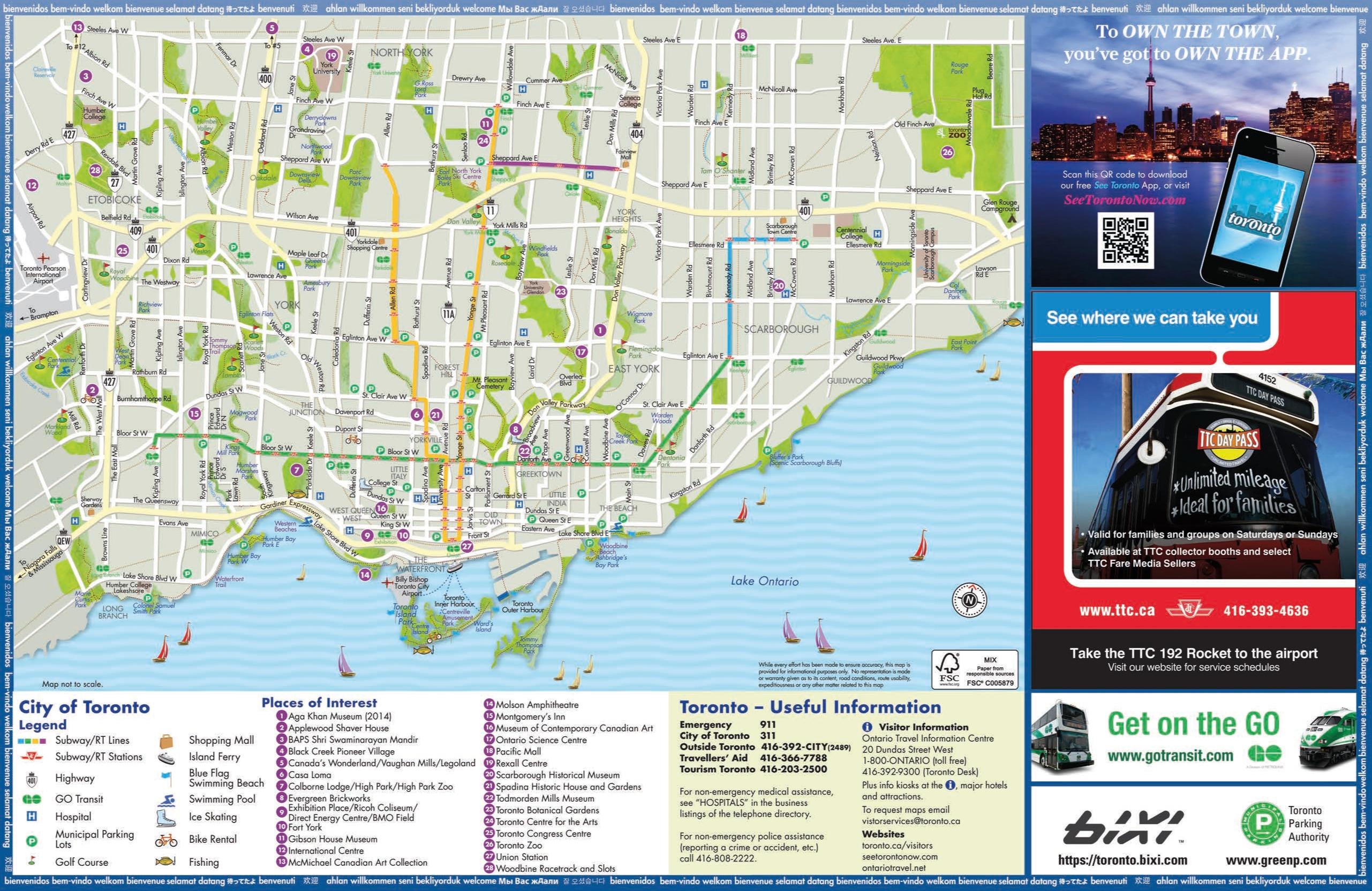
The Toronto sightseeing map shows all tourist places and points of interest of Toronto. This tourist attractions map of Toronto will allow you to easily plan your visits of landmarks of Toronto in Canada. The Toronto tourist map is downloadable in PDF, printable and free.
The city most prominent landmark is the CN Tower as its shown in Toronto tourist map, which once stood as the tallest free-standing land structure in the world at 553 metres (1,814 ft). To the surprise of its creators, the tower held the world record for over 30 years as a tourist attraction in Toronto.
Toronto, the capital of Ontario, is the largest city in Canada and also one of the most diverse. Toronto is home to a dynamic mix of tourist attractions, from museums and galleries to the world famous CN Tower and, just offshore, Toronto Islands as its mentioned in Toronto tourist map. And just a short drive away is Niagara Falls.
The Yorkville neighbourhood is one of Toronto most elegant shopping and dining areas. On many occasions, celebrities from all over North America can be spotted in the area, especially during the Toronto International Film Festival. The Distillery District, Queen West, Harbourfront, the Entertainment District, the Financial District, and the St. Lawrence Market neighbourhood are also popular areas for tourists as you can see in Toronto tourist map.
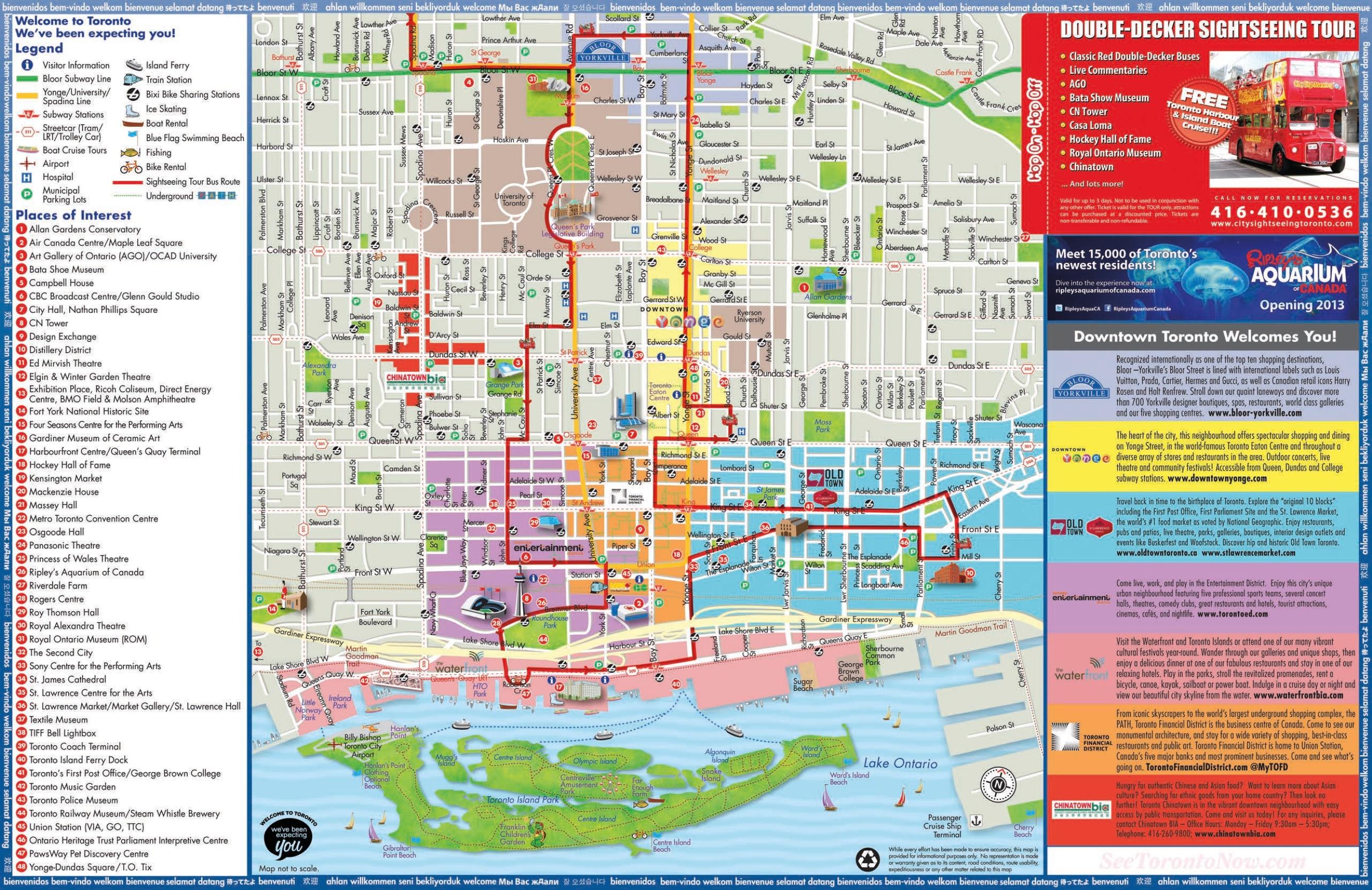
The Toronto attractions map shows the main monuments, museums and parks of Toronto. This tourist places map of Toronto will allow you to easily plan your visits of tourist attractions of Toronto in Canada. The Toronto attractions map is downloadable in PDF, printable and free.
The Royal Ontario Museum (ROM) is a major museum for world culture, natural history and one of the best attractions in Toronto. The Toronto Zoo as its shown in Toronto attractions map, one of the largest in the world, is home to over 5,000 animals representing over 460 distinct species. The Art Gallery of Ontario contains a large collection of Canadian, European, African and contemporary artwork, and also plays host to exhibits from museums and galleries all over the world.
The Eaton Centre is one of North America top shopping destinations, and Toronto most popular tourist attraction with over 52 million visitors annually as its mentioned in Toronto attractions map. Greektown on the Danforth, is another one of the major attractions of Toronto which boasts one of the highest concentrations of restaurants per kilometre in the world. It is also home to the annual "Taste of the Danforth" festival which attracts over one million people in 2½ days.
Toronto is home to Canada most famous "castle" – Casa Loma, the former estate of Sir Henry Pellatt, a prominent Toronto financier, industrialist and military man. Other notable neighbourhoods and attractions include The Beaches, the Toronto Islands, Kensington Market, Fort York, and the Hockey Hall of Fame as you can see in Toronto attractions map.
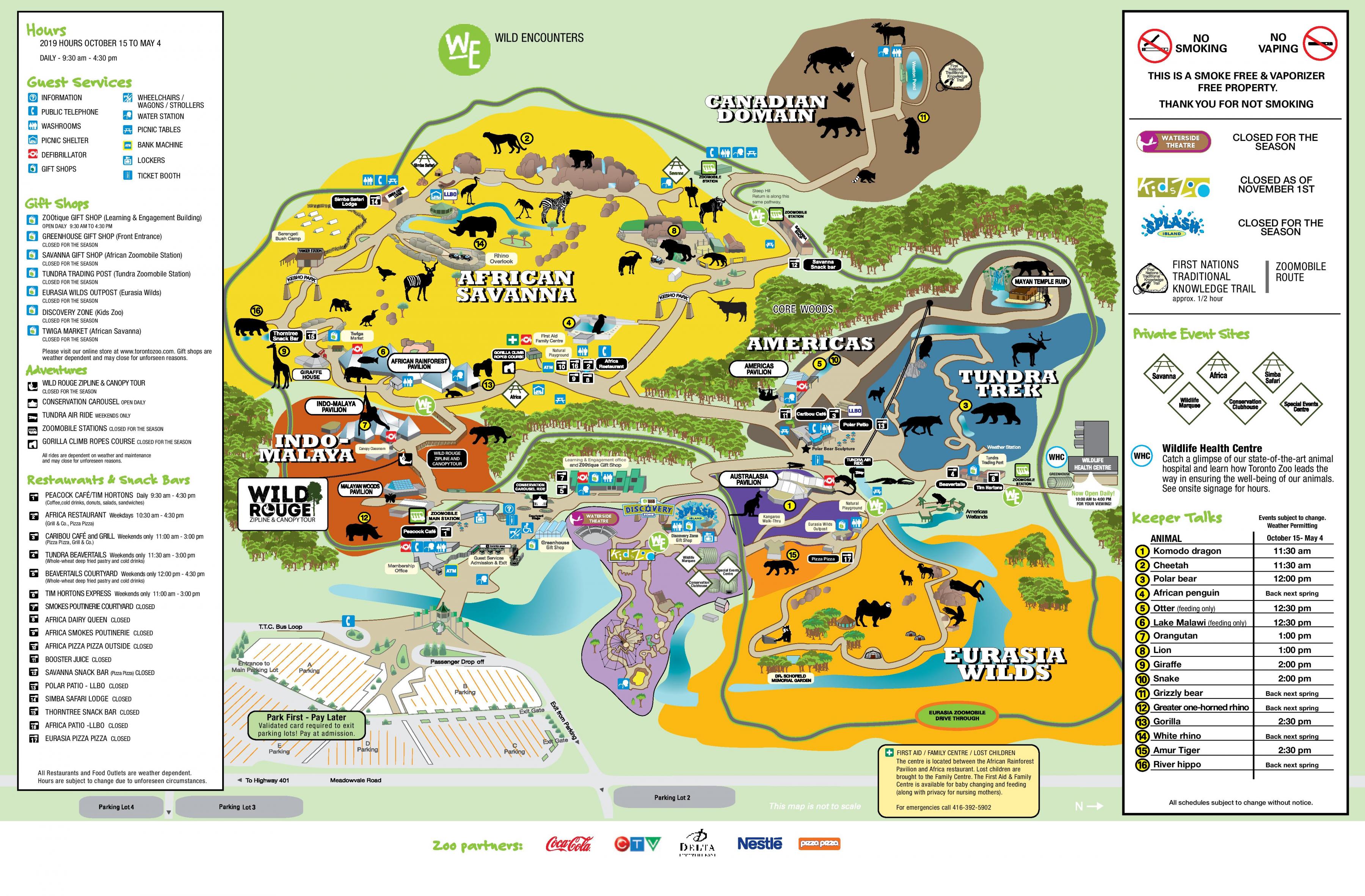
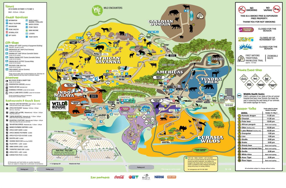
The Toronto zoo map shows recommended tours of the Toronto Zoological Park. This zoo map of Toronto will allow you to easily find out where each animal is and where to picnic in the Zoological Park of Toronto in Canada. The Toronto zoo map is downloadable in PDF, printable and free.
The Toronto Zoo is a zoo located in Toronto, Ontario, Canada as its shown in Toronto zoo map. It opened August 15, 1974 as the Metropolitan Toronto Zoo and is owned by the City of Toronto; the word "Metropolitan" was dropped from its name when the cities of the Municipality of Metropolitan Toronto were amalgamated to form the present-day city of Toronto in 1998.
The Toronto zoo is located near the Rouge River, along the western border of Rouge Park in city east end former borough of Scarborough as its mentioned in Toronto zoo map. Encompassing 287 hectares (710 acres), the Toronto Zoo is the largest zoo in Canada. The zoo is currently home to over 16,000 animals (including invertebrates and fish) representing over 491 species.
Toronto zoo is divided into seven zoogeographic regions as you can see in Toronto zoo map: Indo-Malaya, Africa, Americas, Tundra Trek, Australasia, Eurasia and the Canadian Domain. Some animals are displayed indoors in tropical pavilions and outdoors in what would be their naturalistic environments, with viewing at many levels. Toronto zoo also has areas such as the Kids Zoo, Waterside Theatre and Splash Island.